MARINE BIRD AREAS: South Australia
Written as an Appendix for RESEARCH PAPER: Lyme Disease / Borreliosis: An Overview of Lyme and Direction for further Research required in Australia
|
South Australia Coastline: 3,700 kms
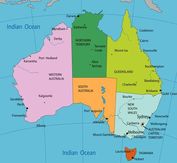
Left: Map of South Australia The information below generally follows the order as listed on the location map by Right: Map of Australia to compare the size of the State / coastline. The 1994 study by Russel et al., to deny the presence of Lyme in Australia, collected and examined ticks from the NSW Coastline: A 2,000km section of Australia’s 35,000+ km coastline (one region/state of Australia and one environmental location) To read more on this see: Lyme Disease: A Counter-Argument to the Australian Government's Denial |
|
Information for : Tasmania, South Australia, Western Australia and Northern Territory is still in note form and yet to be completed.
Basic Notes to date:
“The South-west Marine Region is considered regionally and nationally significant for seabirds” (1).
“The South-west Marine Region is extensive and diverse, covering some 1.3 million square kilometres of both temperate and subtropical waters. It extends offshore from the eastern end of Kangaroo Island in South Australia to Shark Bay in Western Australia - adjacent to the longest coastline in the world facing the Southern Ocean and Antarctica” (2).
(1) Australian Government. Department of Sustainability, Environment, Water, Population and Communities: Species group report card—seabirds. Supporting the draft marine bioregional plan for the South-west Marine Region; prepared under the Environment Protection and Biodiversity Conservation Act 1999. Commonwealth of Australia 2011. http://www.environment.gov.au/coasts/mbp/south-west/publications/pubs/report-card-seabirds.doc
(2) Australian Government. Department of Sustainability, Environment, Water, Population and Communities. South West Marine Region.
http://www.environment.gov.au/coasts/mbp/south-west/
Moving from South Australian – Western Australian border: (South Australia Map: http://www.about-australia.com/maps/south-australia/ )
Coorong National Park: “Stretching more than 130 kilometres, Coorong National Park protects a string of saltwater lagoons which are protected from the Southern Ocean by the sweeping sand dunes of the Younghusband Peninsula”
http://www.environment.sa.gov.au/parks/Find_a_Park/Browse_by_region/Limestone_Coast/Coorong_National_Park
Victor Harbour (Conservation Parks around): http://www.tourismvictorharbor.com.au/conservation_parks.html
Fleurieu Peninsula: Bird Watching in South Australia: http://www.outdoorssa.com.au/BW_Pages/bw_fleurieu.htm
Lists some ConservationParks and Reserves also
Yorke Peninsula: http://www.southaustralia.com/regions/yorke-peninsula-parks-wildlife.aspx
http://www.data-environment.sa.gov.au/marineparks/pdfs/MP13_LYP/MP13_Fig9_Env_A3_Jul10.pdf
Kangaroo Island. Basic facts: 15km from the mainland ; 3rd largest sand island off the coast of Australia;
155km long, 55km wide; home to 4,400 people ; seven times the size of Singapore.
http://www.australiangeographic.com.au/journal/kangaroo-island-where-the-wild-things-are.htm
http://www.southaustralia.com/regions/kangaroo-island.aspx
Kangaroo Island Birdlife: http://www.exceptionalkangarooisland.com/island-wildlife-birds.php
http://www.tourkangarooisland.com.au/wildlife/p354.aspx
Department of Environment and Natural Resources, South Australia. Kangaroo Island: http://www.environment.sa.gov.au/parks/Find_a_Park/Browse_by_region/Kangaroo_Island
Eyre Peninsula:
Department of Environment and Natural Resources, South Australia. Eyre Peninsula: http://www.environment.sa.gov.au/parks/Find_a_Park/Browse_by_region/Eyre_Peninsula
http://i.southaustralia.com/uk/pdf/Eyre_VisitorGuide_07.pdf (Quite a large file)
Head of Bight / Great Australian Bight:
http://www.sawhalecentre.com/head_of_the_bight.html
http://www.ceduna.net/site/page.cfm?u=503
South Australia Map: http://www.about-australia.com/maps/south-australia/
