MARINE BIRD AREAS: Northern Territory
Written as an Appendix for RESEARCH PAPER: Lyme Disease / Borreliosis: An Overview of Lyme and Direction for further Research required in Australia
|
Northern Territory Coastline: 6,000 kms
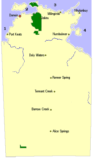
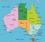
Left: Map of Northern Territory The information below generally follows the order as listed on the location map by AuseMade: Northern Territory Right: Map of Australia to compare the size of the State / coastline. The 1994 study by Russel et al., to deny the presence of Lyme in Australia, collected and examined ticks from the NSW Coastline: A 2,000km section of Australia’s 35,000+ km coastline (one region/state of Australia and one environmental location) To read more on this see: Lyme Disease: A Counter-Argument to the Australian Government's Denial |
|
Information for : Tasmania, South Australia, Western Australia and Northern Territory is still in note form and yet to be completed.
Basic Notes to date:
The Northern Territory has three coastlines adjacent to different oceanographic water masses. The western side abuts the Timor Sea, the northern side the Arafura Sea and the eastern side the Gulf of Carpentaria (1). The Territory has a total of 398 islands, of which 215 are larger than 20 hectares: A large proportion of these islands occur within four major archipelagos; the Crocodile
(17 islands), Wessel and Cunningham (21 islands), English Company (11 islands) and the Sir Edward Pellew (30 islands) groups. The northern coastline of Australia is extremely important for many groups of aquatic birds.
Areas around the Northern Territory coasts and islands (moving from WA/NT to Qld border) include:
WA/NT Border to Arnhem Land
Anson Bay to Fog Bay – “one of the most important areas in the Northern Territory for colonial waterbird breeding and aggregation. The floodplains of both the Daly and Finnis River each support a single colony of more than 10 000 waterbirds, with a further 16
smaller colonies in the vicinity (e.g. on the Moyle and Little Moyle rivers). All waterbird species that nest colonially n the Northern Territory (except glossy ibis) are represented in significant numbers in one or more of these colonies” (2:pg 200).
Beagle Gulf – Darwin Harbour, Bynoe Harbour, Shoal Bay and the Adelaide Riverestuary support nationally significant nesting and/or foraging aggregations of seabirds, waterbirds and shorebirds. Black-naped tern, little tern and eastern reef egret breed on Bare Sand (Bynoe Harbour), south west of Darwin.
Bathurst and Melville Islands (Collectively known as the Tiwi Islands). “The Tiwi Islands lie 20 km north of Darwin and include
Australia’s second and fifth largest islands - Melville and Bathurst Islands, respectively”.
The Islands are separated by approximately two kilometres and Melville Island has a population of around 1000 people, whilst Bathurst’s population is around 1500. “Five seabird breeding colonies are reported on small off-shore islands within this site. Counts of about 60,000 Crested Terns in one colony on Seagull Island, off the north-west coast of Melville Island, are internationally
significant (>1% global population) and believed to be the world’s largest breeding colony of this species…”(3:pg 281).
Van Diemen Gulf– “the estuaries and floodplains on the southern shores of the Van Diemen Gulf including Chambers Bay and the Adelaide, Mary, and West, South and East Alligator rivers) provide extensive shorebird and waterbird feeding habitat, and support one of the most important areas for colonial waterbird breeding in the Northern Territory (with seven significant colonies). The single largest colony of waterbirds occurs on the Adelaide River and is likely to support around 30 000 birds, predominantly egrets, herons and cormorants” (2:pg201)
Arnhem Land:
Cobourg Peninsula: a number of small islands off Cobourg Peninsula
Croker Island: Islands surrounding eg: Lawson, Templer, Oxley, Grant
West Arnhem:
North Goulburn Island. Mainland beach just east of Guion Point
Haul Round Island, Boucat Bay(off Maningrida coast). One of the most significant seabird colonies in NT.
Castlereagh Bay to BoucautBay – “some of the largest flocks of migratory shorebirds in the Northern Territory (with counts of more than 30 000 birds) have been recorded in Boucaut and Castlereagh bays… Shorebirds and waterbirds make use of the extensive mangrove, intertidal mudflat, floodplain, sandy and rocky beach and headland habitats in the area…..There are significant roosts for seabirds…..the coast and on inshore islands (e.g. False Point, Crocodile Island, Yabooma Island)” (2:pg 202).
East Arnhem:
Islands in the: Wessels, English Company and Bromby Island chains. Ie:
Wessel Island chain supports internationally significant nesting sites for some 10 000–30 000 seabirds
Number of Islands off Flinders Peninsula, eg: Garalja, Elcho Island
North-west Gulf of Carpentaria coast / Cape Arnhem/Nhulunbuy area: – “this area supports a large number of nationally and internationally significant nesting and roosting aggregations of seabirds. Particularly large colonial seabird breeding colonies occur on the islands north of the Gove Peninsula….
Higginson Islet, off Nhulunbuy: “located at the northern end of a chain of islands running north from Nhulunbuy. With 5 species (3 breeding in nationally significant numbers) and active for most of the year, it is an extremely significant seabird colony and probably the most important in the NT”.
Islands north of Nhulunbuy ie: Veronica Island, Forlsche Rock, East Bremer Islet & chain of rock islands extending for 3 kms to the south, South East Islet.
Granite Islands, MelvilleBay: “Chain of 4 small rock islands and a few isolated rock outcrops in Melville Bay close to the township of Gove”.
Mainland beach, south of Cape Arnhem: Wide sand ocean beach with extensive dunes. Small Little Tern colony reported by
M. Stevens (PWCNT, Nhulunbuy).
Mainland 2-3kms south of Mt.Alexander: Sand beach, along mainland coast, with scattered rocks, coral..
Cape Shield Isle Woodah Nicol Island
Bickerton Island (in between mainland and Groote Eylandt): North/south chain of islands surrounding
Groote Eylandt and surrounds – “the eastern coast of Groote Eylandt and numerous offshore islands, particularly to the north and east, host nationally significant sites for the colonial breeding and roosting of seabirds” ( pg: 203)
Numbulwar area: Mainland - coast sand-spit, just north of the town of Numbulwar.
Islands: Minintirri (NE), Sandy (SE)
Maria Island, Limmen Bight. (16kms from mainland) Has one of “the largest Silver Gull colonies in the Top End, although it is still small by southern standards.. Eastern (ocean) side well used for seabird roosting and the island has reasonable numbers of shorebirds. Osprey and White-bellied Sea Eagle seen breeding…”
Sir Edward Pellew Group of Islands (SW corner of Gulf of Carpentaria). Larger islands in the group include: South West Island (600 metres off mainland), West Island (3kms off mainland), Centre Island (5kms), VanderlinIsland (5.5km) and North Island(25kms). There are many seabird breeding sites throughout the thirty islands that make up the Sir Edward Pellew Island Group. “Large numbers of seabirds inhabit the Barrany (North Island) National Park, Cape Pellew and the outer islands of the Sir Edward Pellew Group. The islands provide one of the most important areas for colonial seabird breeding in the Northern Territory…”
Mainland:SW Gulf of Carpentaria:
“..the mainland coast provides extensive and diverse habitat for large numbers of shorebirds and waterbirds. The mouth of the McArthurRiver is an important staging point for migratory birds” (2:pg 203). This area is part of quite a long sandy coastline starting at the eastern end of Port McArthur and extending past the Queensland border, which has quite a number of Little Tern colonies, particularly on the sand spits at the mouths of creeks and rivers. Areas identified here include:
Pelican Spit: (Mainland opposite Vanderlin island)
Spit near mouth of Stockyard Creek (east of Robinson River)
Sand Spit Island, between the mouth of RosieCreek and Bing Bong Station, “A 500+m long….sand island that is only a few hundred metres offshore and becomes joined to the mainland at very low tides.
The majority of the information on bird areas sourced from the readings one (1) and two (2):
(1) Technical Report. The Distribution and Status of Colonial Breeding Seabirds in The Northern Territory. Ray Chatto 2001. Parks and Wildlife Commission of the Northern Territory. ISBN 07245 27885.
http://www.nt.gov.au/nreta/publications/wildlife/science/pdf/2001_seabirds_rpt70.pdf
*The distribution and status of colonial breeding seabirds in the NT Appendix B –Confirmed colonies (pages 99-177)
**For a visual image of these sites– see Page 13; Figure 3. Location of colonies with differing numbers of birds:
(2) Appendix D6. North Marine Region Protected Species. Group Report Cards: Bird http://www.environment.gov.au/coasts/mbp/publications/north/pubs/profile-appendixd6.pdf
(3) Tiwi Islands: Sites of Conservation Significance. Northern Territory Government.
http://www.nt.gov.au/nreta/environment/conservation/pdf/09_tiwi.pdf
The natural occurrence of northern quolls Dasyurus hallucatus on islands of the Northern Territory: assessment of refuges from the threat posed by cane toads Bufo marinus. Report to The Australian Government’s Natural Heritage Trust. John Woinarski, Brooke Rankmore, Alaric Fisher, Kym Brennan and Damian Milne. December 2007 http://www.nt.gov.au/nreta/wildlife/programs/quoll/pdf/quolls_nt_islands.pdf
*See Table 1 (pages 15-20 for distances of some islands):
Introduced Animals on Northern Territory Islands: improving Australia’s ability to protect its island habitats from feral animals. Final Report For the Australian Government Department of the Environment and Heritage. Prepared by: Brooke Rankmore. The
Northern Territory Government (2005). http://www.environment.gov.au/biodiversity/invasive/publications/pubs/nt-islands-report.pdf
