MARINE BIRD AREAS: Victoria
Written as an Appendix for RESEARCH PAPER: Lyme Disease / Borreliosis: An Overview of Lyme and Direction for further Research required in Australia

|
Victoria Coastline: 1,800kms
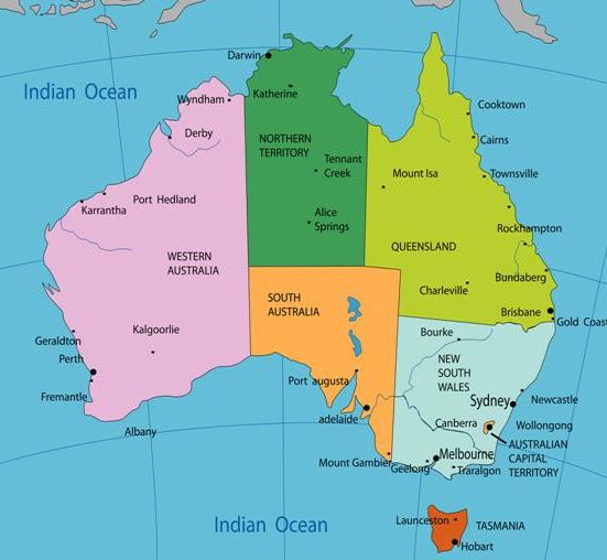
Left: Map of Victoria The information below generally follows the order as listed on the location map by AuseMade: Victoria Right: Map of Australia to compare the size of the State / coastline. The 1994 study by Russel et al., to deny the presence of Lyme in Australia, collected and examined ticks from the NSW Coastline: A 2,000km section of Australia’s 35,000+ km coastline (one region/state of Australia and one environmental location) To read more on this see: Lyme Disease: A Counter-Argument to the Australian Government's Denial |
|
Travelling from the New South Wales to South Australian border:
The Ninety Mile Beach Marine National Park runs adjacent to the McLaughlans Beach Coastal Reserve: Ninety Mile Beach is a sandy stretch (just over 150 kms long) of south-eastern coastline along the GippslandLakes region. Shorebirds such as plovers and spoonbills and seabirds such as penguins and terns utilise this area (1-3).
Travelling a little further along the coastline is Wilsons Promontory which protrudes into Bass Strait and forms the southernmost point of the south eastern Australian mainland. Wilsons promontory National Park is a site for shorebirds and seabirds such as, cormorants, petrels, terns and gulls. The Marine National Park lies adjacent to the Wilsons Promontory National Park.“The Marine National Park surrounds Kanowna, Anser and Wattle Islands, which are important breeding or nesting sites for Australian fur-seals, little penguins and several seabirds, and all are a part of the Western Port National Park” (4: pg158).
Further down the coast from Wilsons Promontory is Phillip Island in Westernport Bay which is connected to the mainland by a 640metre long bridge. It is well known for the penguin population on the island. Along with the penguins (approx 26,000), other seabirds include Short-tailed Shearwaters (450,000 nests) and Pacific gulls (approx 500) (5-8).
Around 150kms along the coast from Phillip Island is Port Phillip Bay (Mornington Peninsula side): The bays sandy beaches stretch from Sorrento, on the Mornington Peninsula, to Queenscliffe, on the opposite side of the Bay (9-11). “The coastline of Port Phillip Bay is about 260km Long [35 times the size of Sydney Harbour], extending from the headland at Point Lonsdale around to the similar headland at Point Nepean. The two headlands border the entrance to Port Phillip Bay, which is just over 3 km wide at high spring tides” (12:pg 4) “Port Phillip Bay is home to a vast number of birds dependent on its coastal wetlands and sheltered waters. The area is of international significance due to the presence of large numbers of migratory wading birds, seabirds and because of its importance to waterfowl the endangered Orange-bellied Parrot. It is the sixth most important area in Australia for migratory waders and the most important in Victoria” (13).
From the opposite side of Port Phillip Bay begins “The Great Ocean Road”, which encompasses the Victorian coastline from Geelong, west to Nelson on the South Australian border. Along this coastline there are many areas for migratory marine birds (14). Two of these areas being Port Campbell National Park and MiddleIsland (15). There are numerous areas for seabirds within Port Campbell National Park, one location being MuttonbirdIsland (Victoria), west of Lord Ard Gorge which is 60metres from the mainland and is the breeding grounds to over 200,000 migrating shearwaters (16). MiddleIsland at Warrnambool is home to seabirds such as the Little Penguin, Short-tailed Shearwater and Black Cormorants. The island is close to the coastline, indeed it is possible to walk to there via a tidal sand bridge at low tide (17).
REFERENCES: Marine Bird areas - Victoria
(1) Ninety Mile Beach Marine National Park Management Plan. Parks Victoria; July 2006. ISBN 0 7311 8354 1
http://parkweb.vic.gov.au/__data/assets/pdf_file/0004/313366/Ninety-Mile-Beach-Marine-National-Park-Management-Plan.pdf
(2) Parks Victoria Technical Series No. 1 Marine Natural Values Study (Ninety Mile Beach)
http://parkweb.vic.gov.au/__data/assets/pdf_file/0018/314730/20_1046.pdf
(3) Ninety MileBeach: http://en.wikipedia.org/wiki/Ninety_Mile_Beach_(Victoria)
(4) Parks Victoria Technical Series No. 1 Marine Natural Values Study (Wilsons Promontory)
http://parkweb.vic.gov.au/__data/assets/pdf_file/0007/314728/20_1044.pdf
(5) http://www.australia.com/itineraries/nsw_sydney_to_melbourne_coastal_drive.aspx
(6) Phillip Island,Victoria: http://en.wikipedia.org/wiki/Phillip_Island_(Victoria)
(7) Phillip Island IBA: http://www.birdata.com.au/iba.vm
(8) Phillip Island Official Tourism Website: http://www.visitphillipisland.com/about_phillip_island.html
(9)Melbourne sightseeing: Port Phillip Bay: http://www.melbourne.com.au/bay.htm
(10)Victoria: Port Phillip Bay: http://www.austtravel.com.au/victoria_port_phillip_bay.htm
(11) Department of Primary Industries: Good visual of Port Phillip Bay’s “inland” location:
http://new.dpi.vic.gov.au/fisheries/about-fisheries/publications-and-resources/fisheries-reports/fisheries-report-series/port-phillip-bay-fish-in-our-waters
(12) Changes on the Coastline of Port Phillip Bay: Published by the Victorian Government Department of Sustainability and Environment. Office of the Environmental Monitor 2011 http://www.oem.vic.gov.au/Assets/986/1/ChangesontheCoastlineofPPBBookforWeb2011.pdf
(13) Friends of Mud Islands Inc. RAMSAR Information on MudIslands, Port Phillip Bay http://home.vicnet.net.au/~fomi/html/ramsarinfo.php
(14)Victoria: Great Ocean Road: http://www.victoria.visitorsbureau.com.au/regions/great-ocean-road.html
(15) Parks Victoria: PCNP: http://parkweb.vic.gov.au/explore/parks/port-campbell-national-park
(16)Port Campbell National Park: http://visitgreatoceanroad.org.au/great-ocean-road/destinations/the-twelve-apostles/port-campbell-national-park
(17) Warrnambool Coastcare Landcare Group: http://www.wclg.com.au/middle-island/
